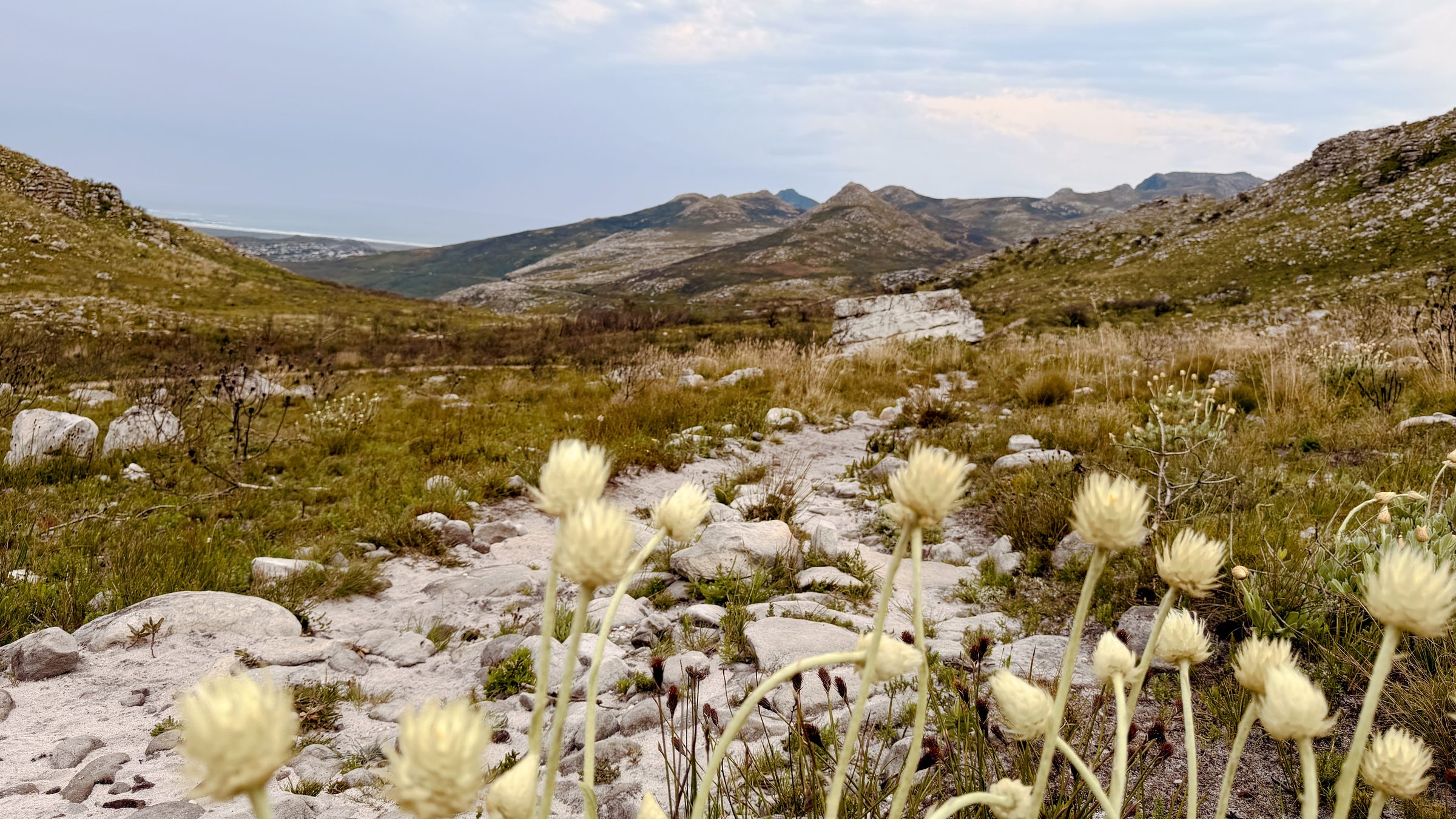
#9 Toad to Toad
Lakeside → Noordhoek | One way One proper climb, beautiful Silvermine views and a long, runnable descent all the way to Noordhoek. Starting at The Toad on the Road in Lakeside and finishing at The Toad in the Village, this route is all about earning your weekend reward. Complete the route and earn your Cape Trail finisher badge.
Route information
Last verified · October 2026
Why it made the challenge
Why we chose it
Because not every trail day needs to end back at your car.
Toad to Toad is a proper A to B adventure: start in Lakeside, get the climbing out of the way early, then cruise through Silvermine and slowly make your way across the mountain to Noordhoek.
It's runnable, social and just challenging enough to make that finish feel earned. Do it on a weekend, bring a few friends, arrange a lift home and make an afternoon of it.
Scenic highlights
- Silvermine views opening up at the top of the climb
- Long, gradual and runnable gravel descent
- Pretty single track down towards Noordhoek
- Finishing at The Toad in the Village
Key challenges
- A steep road warm up and one significant climb early on
- Two easy to miss turns at 5.6 km and 6.7 km
- Road crossings at Boyes Drive and Ou Kaapse Weg
Step-by-step navigation guide
- Start
The Toad on the Road, Lakeside
Start your watch at the parking gate and head uphill along Boyes Drive. It's a steep little road section to warm up those legs.
- 1.8 km
Trailhead
Look for the trailhead on your right. Cross the road carefully and start climbing. This is pretty much the only significant climb of the route, so get it done and enjoy what's coming next.
- 2.9 km
The descent begins
As you reach the top, the Silvermine landscape opens up, with lovely views towards Noordhoek, where you're heading.
Follow the pretty little single track downhill. After about 100 metres, it opens onto a wide gravel road. From here, enjoy some beautifully runnable, gradual downhill.
- 5.6 km
Sharp left turn
Keep an eye on your navigation here. Take a sharp left just above Silvermine Waterfall. If you've reached the waterfall turnoff, you've gone too far.
Continue along the gravel road for another 700 metres until you reach a fork. Keep right, and the gravel road will soon narrow into a lovely little single track.
- 6.7 km
Descent towards Noordhoek
Take another right onto a smaller path. This turn is easy to miss, so keep an eye out.
Now you're heading properly downhill towards Noordhoek. Follow the single track all the way down to the stream, cross the little bridge and join the paved Silvermine Road.
Once you join the paved Silvermine Road, continue straight towards Ou Kaapse Weg. Cross the main road carefully and pick up the Silvermine Greenbelt path on the other side.
The path follows Silvermine Road, so you can stay off the tarmac and enjoy a lovely, easy stretch towards Noordhoek.
- 12.4 km
Village Lane
Turn onto Village Lane and make your way into Noordhoek Village from the back. You're almost there!
- Finish
The Toad in the Village
You've made it from Toad to Toad! Time for a well-earned drink.
Once you finish, sync your activity to Strava. After your route is verified, you'll receive a finisher badge on your Cape Trail profile, and you can choose to publish your completion to the leaderboard.
Not a bad way to finish a trail run!
Route Highlights
A few more reasons to add this route to your list.
Important
- Route information is provided as a guide only.
- Conditions may change without notice.
- Always assess weather, trail conditions, route suitability, and your own abilities before setting out.
- Participants are responsible for their own safety and decisions at all times.
The record board for this route.
Verified completions only, one row per athlete using their best accepted attempt. Climb the board by returning and improving your time.
Loading…
Before you go
Practical details to help you complete the route safely.
Park at The Toad on the Road parking lot in Lakeside. Start your watch at the parking gate, not in the car, so your activity lines up for verification. Don't leave valuables visible in your car. This is a one way route, so arrange a pickup from Noordhoek before you set off.
Take care on the two road crossings: Boyes Drive at the trailhead around 1.8 km, and Ou Kaapse Weg at 10.1 km, which is a busy main road. Cross carefully and only when it is clear. The turns at 5.6 km and 6.7 km are easy to miss, so keep an eye on your navigation there. Run or hike with a buddy where you can, and let someone know your plan.
No reliable drinking water on the route. Carry everything you need, especially in summer.
Patchy
Dogs are allowed with a valid SANParks My Activity Permit. Keep them on a lead near the road sections and carry water for them too.
Daylight hours only.
SANParks Emergency: 086 110 6417
From the Trail
A little glimpse of the route through the eyes of the Cape Trail community.
Got a good one? Share your photos with us and we might add our favourites to the gallery.
Safety & responsible trail use
Cape Trail provides guidance, not guarantees. Please read before heading out.
Water sources shown on routes are seasonal and may be dry. Never rely on natural water sources, always carry sufficient water.
Trail conditions may change due to weather, erosion, maintenance work, fire, flooding, or other environmental factors.
Route descriptions and photographs are provided as guidance only. Users remain responsible for navigation and route-finding decisions.
Mountain weather can change rapidly. Users are responsible for checking conditions before starting.
Users participate entirely at their own risk.
Related routes
More trails in the challenge.

#1 Muizenberg Peak
Muizenberg, Cape Peninsula
#2 Magic Forest
Echo Valley, Cape Peninsula
#12 The Groot Half
Constantia Nek, Table Mountain