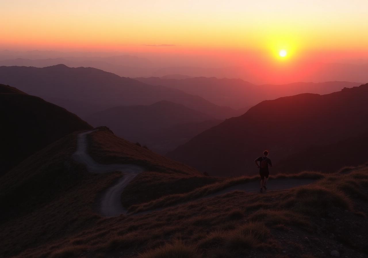
Sunset Contour
An easy contour with the best golden hour view of the city bowl and Atlantic seaboard.
Route information
Last verified · February 2026
Route features
What to expect from the trail itself.
Before you go
Practical details to help you complete the route safely.
Signal Hill upper parking
Carry a headlamp if descending at dusk.
None. Bring a small bottle.
Strong
Why it made the challenge
Why we chose it
Sunset Contour earned its place in the challenge for the way it combines accessibility, beauty, and a genuine mountain feel — exactly the spirit of Cape Trail.
Who it's for
Hikers and trail runners with comfortable mountain experience. Bring appropriate footwear and respect the conditions.
Step-by-step navigation guide
Designed so you can complete this route without a GPS watch.
- 0.0 km
Trailhead
Start from the lower parking. Follow signs marked 'Contour Path'.
- 1.8 km
First climb
Steady switchbacks through fynbos. Pace yourself — the views start soon.
A wooden bench at km 1.2 makes a good first water stop. - 4.5 km
Ridge junction
Stay right at the cairn. The left line drops to a parallel valley.
In cloud, the junction is easy to miss — slow down here. - 7.2 km
High point
Saddle with 360° view. Good wind shelter behind the rocks if needed.
- Photo coming soon10.0 km
Descent
Gentle runnable contour back down. Watch loose gravel after the bend.
- Photo coming soon12.4 km
Finish
Back at the parking. Submit your activity to log the route.
Important
- Route information is provided as a guide only.
- Conditions may change without notice.
- Always assess weather, trail conditions, route suitability, and your own abilities before setting out.
- Participants are responsible for their own safety and decisions at all times.
Safety & responsible trail use
Cape Trail provides guidance, not guarantees. Please read before heading out.
Water sources shown on routes are seasonal and may be dry. Never rely on natural water sources — always carry sufficient water.
Trail conditions may change due to weather, erosion, maintenance work, fire, flooding, or other environmental factors.
Route descriptions and photographs are provided as guidance only. Users remain responsible for navigation and route-finding decisions.
Mountain weather can change rapidly. Users are responsible for checking conditions before starting.
Users participate entirely at their own risk.
The record board for this route.
Best times posted by Cape Trail participants this season. Climb the board by returning and improving your time.
| # | Participant | Best time | Date |
|---|---|---|---|
| 1 | Tomás Khumalo Stellenbosch | 45m 19s | 25 May |
| 2 | Sara Williams Newlands | 46m 38s | 2 May |
| 3 | Aisha Coetzee Cape Town | 47m 17s | 20 May |
| 4 | Bongi Joubert Constantia | 50m 53s | 28 Apr |
| 5 | Jake Khumalo Tokai | 51m 11s | 27 May |
| 6 | Anya Smith Sea Point | 54m 33s | 6 Jun |
| 7 | Liam Dlamini Stellenbosch | 51m 34s | 25 May |
| 8 | Imke Davies Kommetjie | 53m 34s | 28 May |
| 9 | Claire Khumalo Kommetjie | 55m 59s | 12 May |
| 10 | Claire Williams Hout Bay | 56m 25s | 13 May |
| 11 | Nadia Smith Newlands | 54m 55s | 18 May |
| 12 | Mia Ndlovu Newlands | 1h 06m | 23 May |
| 13 | Anya Dlamini Hout Bay | 1h 03m | 16 Apr |
| 14 | Kabelo Mthembu Tokai | 1h 05m | 15 Apr |
| 15 | Theo Reyes Constantia | 1h 09m | 6 Jun |
Related routes
Nearby or similar trails in the challenge.
Muiz Peak
Muizenberg, Cape Peninsula
Magic Forest: Echo Valley
Echo Valley, Cape Peninsula
Nursery Ravine to Grootkop Loop
Constantia Nek, Table Mountain